While the construction of the canal inspired a great deal of urbanization of the Niagara Region, but not all towns came into being because of the canal. Even before the canal came to the region, the area attracted a great deal of colonization in the days during and following the American Revolution mainly by Loyalists. Officially today they’re called United Empire Loyalists, and they formed the core of the original European population in Upper Canada, created out of the Province of Quebec. Quebec had been under British occupation since the end of the French-Indian War, and the government was maintained to match that of New France mainly to help keep the local French-Canadian population under the thumb. The British Parliament divided Quebec into two Provinces, creating Lower Canada and Upper Canada. The first significant population centres formed at Niagara/Newark (today Niagara-On-the Lake), York (Toronto), and Kingston. But even then smaller communities quickly built through the 1780s and 1790s usually around some major water source to allow not only power but transportation. Today we’ll be exploring the major population centres around the Welland Canal, St. Catharines, Thorold, and Welland.

Mamiya m645 – Mamiya-Sekor C 35mm 1:3.5 N – Kosmo Foto Mono 100 @ ASA-100 – Kodak HC-110 Dil. H 10:00 @ 20C
The oldest and largest population centres along the Welland Canal is the city of St. Catharines. The first settlers arrived at the confluence of Dick’s Creek and Twelve Mile Creek. The area already saw settlement by the Iroquois who carved trails out through to the woods. The first European settlers were former soldiers in the Butler’s Rangers. Two soldiers, Jacob Dittrick and John Hainer, took their land grants in the region arriving in 1780. Others followed the government to support the region a quartermaster, Duncan Murray, arrived to distribute those supplies. The small settlement became known as either The Twelve (for the creek) or Murray’s District (for the quartermaster). Being the only major urban centre between Niagara (or Newark) and York. While there have also been several other names tossed around for the early settlement including Shipman’s Corner, but most agree that since 1796 the name of the settlement became St. Catharines. Among the citizens that came during the 1790s included the Merritt family and their one-year-old son, William. By the end of the century, the settlement had a tavern which acted as a government office, meeting hall, post office, and stagecoach office. It also boasted a church and schoolhouse. Despite being a town that focused on farming and milling the area avoided damage during the Anglo-American War of 1812, which saw a great deal of destruction of infrastructure by the invading American forces. The area only grew in the post-war era joining the ranks of the new villages in the expanding ProvinceProvince. What set the settlement apart is that rather than the traditional grid system for the community’s roads they followed a more radial pattern using those former trails carved by the Iroquois. Even before the arrival of the Welland Canal St. Catharines saw incorporation as a village. So it would be no surprise the St. Catharines would become the centre of the canal including the headquarters for the Welland Canal Corporation. While already a centre of industry and transportation, the canal only accelerated the fortunes of the village. By 1846 and the opening of the second canal St. Catharines incorporated as a town, with all the perks. Daily mail delivery, mills across the length of canal valley, a weekly newspaper, grammar school, six churches along with banks, hotels, shipyards, and taverns. William Hamilton Merritt, being an ardent abolitionist, also ensured that St. Catharines became a haven for escaped slaves. But with slavery only having been abolished in the Empire in 1833 racial sentiments remained present across Canada, those former slaves and black citizens settled in a small area known as Coloured Town (around the intersection of Geneva and Welland today). About eight hundred lived in the area, a majority being former American slaves. But all was not the picture of a perfect arrangement; race riots became common through the early 1850s along with strikes and work stoppages. Despite being the population centre, the route of the Great Western Railroad bypassed St. Catharines, carving its way across the Welland Canal at Merritton. The arrival of the Welland Railway solved railroad access which later became a part of Grand Trunk along with Great Western. When construction of the new canal started in 1872, the route of the old canal could no longer support the new ships travelling the waterways engineers plotted a new route bypassing the core of St. Catharines. It did not matter in the long run, St. Catharines obtained city status in 1876, and two years later the arrival of McKinnon & Dash secured the city’s manufacturing power. When the navigation along the Second Canal was curtailed in 1881 with the opening of the third canal, the cities core industries remained reliant on the water power generated by the canal. In 1887 the arrival of electricity opened up an interurban transit option and the ability to move the industry away from the canal. Some factories, including Canada Hair Cloth, generated their electricity, other sources included the small generating station at DeCew Falls. But the late 19th century also brought about improved roads through the city and a series of high-level bridges that crossed the old canal channels. McKinnon would relocate along with many of the city’s industrial businesses to the outskirts of the growing city by 1900. The First World War only improved the manufacturing power of St. Catharines and brought the city into the budding automotive industry. McKinnon got on the radar of Detroit, and General Motors ended up purchasing the company in 1929. The closure of the second and third canals in 1935 did not affect the city as much as other canal communities, mainly because the city exploited the former canal sites and filled them in to allow for further expansion. In 1960 St. Catharines incorporated as a city and used that power to annex several smaller communities, among them Merritton, Port Weller, and Port Dalhousie. Also during the later century St. Catharines to preserve and restore much of the old second canal and undertake a great deal of clean up of the former sites. Most of which took place in the early 2000s along several former industrial sites and the downtown of St. Catharines and through the historic cores of Merritton and Port Dalhousie.

Minolta Maxxum 9 – Minolta Maxxum AF 28mm 1:2.8 – Kodak Tri-X 400 @ ASA-400 – Kodak D-76 (1+1) 9:45 @ 20C
Minolta Maxxum 9 – Minolta Maxxum AF 28mm 1:2.8 – Kodak Tri-X 400 @ ASA-400 – Kodak D-76 (1+1) 9:45 @ 20C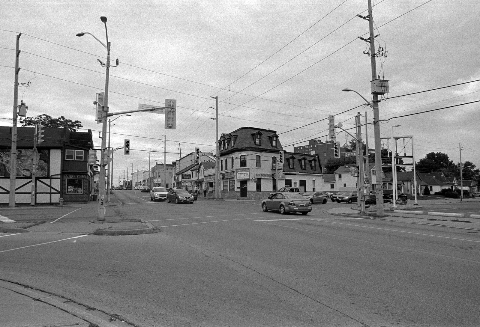
Minolta Maxxum 9 – Minolta Maxxum AF 28-135mm 1:4-4.5 – Kodak Tri-X 400 @ ASA-400 – Kodak D-76 (1+1) 9:45 @ 20C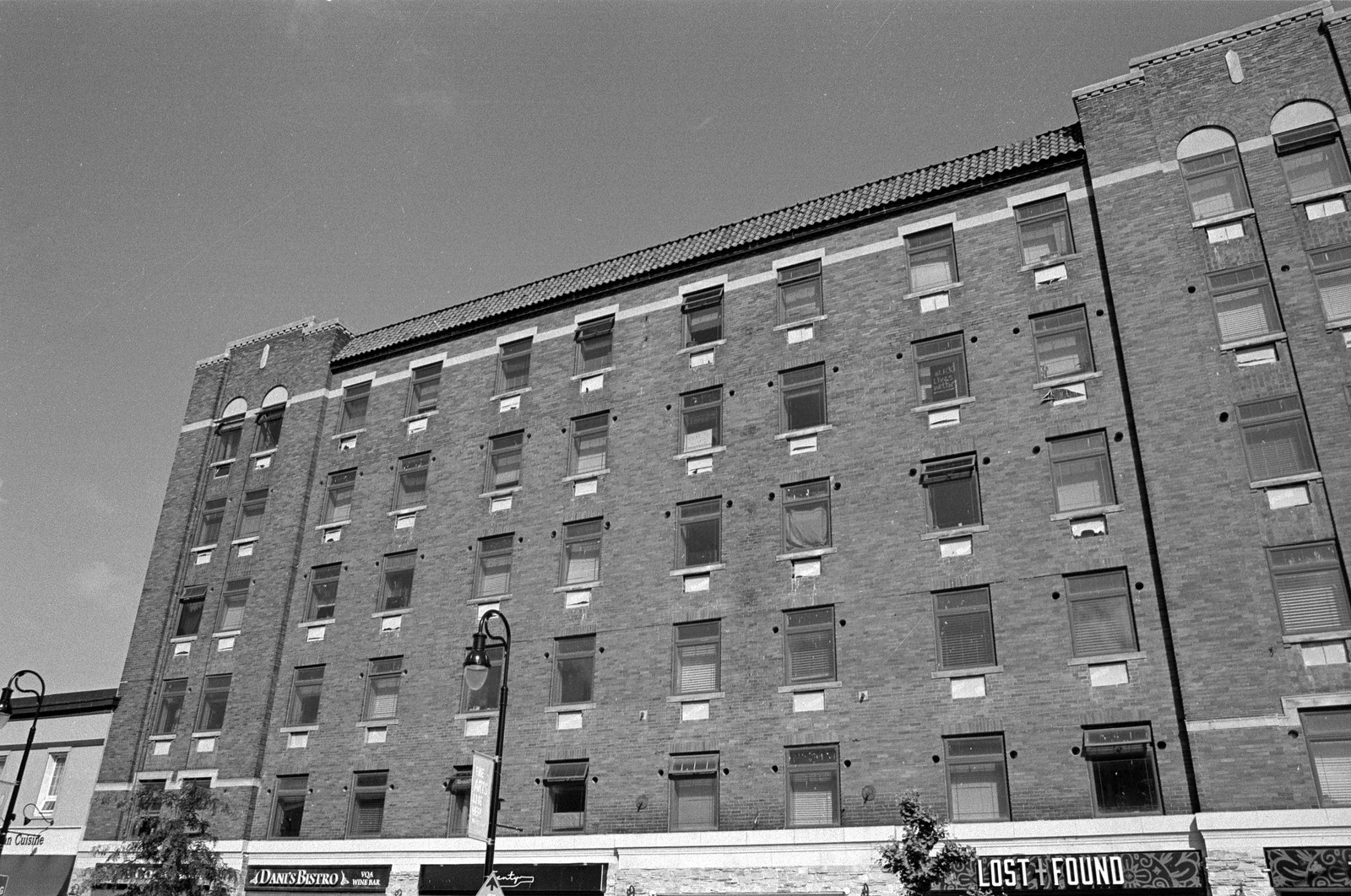
Minolta Maxxum 9 – Minolta Maxxum AF 28mm 1:2.8 – Kodak Tri-X 400 @ ASA-400 – Kodak D-76 (1+1) 9:45 @ 20C
At the same time that loyalists began the settlement that would grow into St. Catharines, they also were settling above the Niagara Escarpment. Two small settlements grew into small urban centres, taking the name Cook’s Mills and Beaverdams. Neither grew to any large size, but due to their strategic importance, both saw action during the Anglo-American War of 1812. When work commenced on the first canal in 1824, the upper portion of the mountain locks grew into a small shantytown known to the local workers as Stumptown. Like the four settlements at the base of the Escarpment, Stumptown’s position along the mountain locks provided ample water supplies for not only mills but also a large canal service industry to form following the canal’s opening. George Keefer, one of the original supporters of the canal project, opened a grist mill in Stumptown in 1827. Besides the canal, Stumptown had access to the vast stone resource of the Escarpment in the form of a quarry allowing the mills to be constructed from stone rather than wood. Stumptown quickly outgrew the two earlier settlements with a population of 300 by the time the first canal opened. Most of the population would come from former canal workers who decided to remain in the Province rather than seek their fortune elsewhere. Stumptown’s growth would only accelerate with the construction of the second canal. The new canal would not only boost the population to 1,000 by the time the channel open but also allow for bigger mills to open along the new channel. Stumptown took the name Thorold in 1846 and a year later one of the first Cotton Mills in Canada West Open along with the massive Welland Mill which grew to be one of the top flour mills in Canada. Unlike many communities, Thorold’s growth occurred on both sides of the canal, locals would use the locks to walk across the canal, and by the arrival of a second canal, a swing bridge allowed for easier movement. Incorporation as a village took place in 1850 and had four flour mills (three of which were considered the best in Canada), two cement plants, a quarry, a sawmill, carding mill, machine shop, three churches, hotels, and taverns. The growth allowed Thorold to incorporate as a town in 1870. Shortly after a fire broke out and destroyed much of the downtown, resulting in the creation of a local fire department, thanks to the position of Thorold, even when the Third canal began construction in 1872, the top of the new Mountain Locks would remain in Thorold. And when navigation between Thorold and St. Catharines was cut off in 1881 along the second canal, in 1887 a new Interurban electrical railway opened to allow movement of goods and workers to move between the growing industrial corridor between the three major industrial centres. The introduction of electricity allowed the heavier industry to move into the town and many of the machines used in the factories in the other growing communities of St. Catharines and Merritton were built in Thorold. By the turn of the century, Thorold had more job openings than workers, no one in the town was wanting for work. Ore processing came in the early 20th century as mineral extraction took place in Northern Ontario, along with pulp and paper production. Glass production and tableware also joined the growing factory core in Thorold. After the war, many of the flour mills ceased production including the Welland Mill in 1929 and the closure of the second canal left an unsightly scar through the community. While there was a brief resurgence through the Second World War, the community was marked by decline. During the construction of the Welland, Bypass overran the former battle site of the Battle of Beaverdams in the 1960s. The town took the chance to reclaim the old canal channel filling in the whole section through town and creating the Battle of Beaverdams Park in the downtown to house the memorials that would have been flooded with the new bypass. The efforts succeeded and Thorold became a city in 1970 taking over Cook’s Mills, Beaverdams, Port Robinson and Allanburg. The second wave of urban renewal took place in the early 2000s with restoration of the old Welland Mills, and the downtown took place, to ensure that tourism would still come to the community drawn to the top of the massive flight locks on the 4th canal.

Minolta Maxxum 9 – Minolta Maxxum AF 100mm 1:2.8 MACRO – Kodak Tri-X 400 @ ASA-400 – Kodak D-76 (1+1) 9:45 @ 20C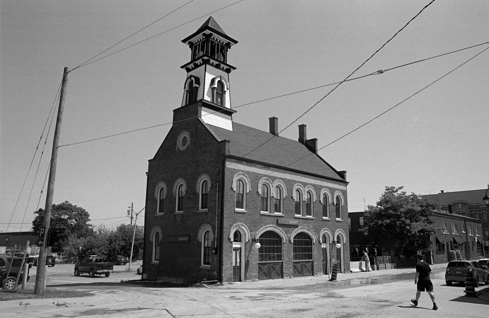
Minolta Maxxum 9 – Minolta Maxxum AF 35-70mm 1:4 – Kodak Tri-X 400 @ ASA-400 – Kodak D-76 (1+1) 9:45 @ 20C
Minolta Maxxum 9 – Minolta Maxxum AF 28mm 1:2.8 – Kodak Tri-X 400 @ ASA-400 – Kodak D-76 (1+1) 9:45 @ 20C
Minolta Maxxum 9 – Minolta Maxxum AF 28mm 1:2.8 – Kodak Tri-X 400 @ ASA-400 – Kodak D-76 (1+1) 9:45 @ 20C
If it hadn’t been for the Welland Canal, specifically the extension of the canal out to Lake Erie, the city of Welland would not have existed. The marshy land around the area prevented any significant urban development. However, a small community called Crowland did spring up in the 1780s and grew slightly during the construction of the feeder channel in the early days of the first canal. When the canal saw its expansion in 1831, engineers used an aqueduct to carry the ships over the Welland River and install a lock to allow travel into the canal and onto the Welland River. The camp took the name Aqueduct and grew slowly around the lock, mainly services related to the canal and a few small mills further along in Crowland. The trouble remains there was no space for the community to expand, the marshland, river, and canal curtailed any growth. At least when the second canal ran through the area the lock onto the Welland River expanded and gave the small community the name as a major transit hub for inland waterway navigation. In 1844 the settlement took the name Merrittville to honour the canal’s founder when the post office arrived. Next to the service industry, three small mills operated along the canal’s bank thank the improved water supply on the second canal. Yet even by 1850 the settlement only had 150 permanent residents but could swell to 350 with transient workers. Oddly enough it gained village status eight years later when Welland County saw the creation, and it was named the county seat. It also took a new name, Welland that same year. (Thus allowing the Merritt name to go to Merritton which had previously been Welland City). Welland wouldn’t see any significant expansion until the arrival of railroads and the construction of the third canal. Better land dredging, bridges, and a larger channel helped bring more people and more importantly, electricity. Welland incorporated as a town in 1878, and many began to eye the community for greater things. In 1887 a small hydroelectric plant opened up in the town proper. It marked the arrival of Beaty & Sons, a manufacturing company that specialized in steam engines and boilers that would be used for shipbuilding activities elsewhere on the canal. The discovery of clay allowed for brickwork to open up. As the railroad expanded and the Canadian Pacific line opened up the west markets, no less than five networks converged on Welland. Another driver of increased growth was the discovery of natural gas in the area. The mills were quickly abandoned in favour of manufacturing into the 1890s, household goods, industrial machines, ironworks, fencing, foundries quickly filled in the space between Crowland and Welland cementing the two communities as the industrial heavyweight. Despite this industrial growth, many still saw Welland as a rural and agricultural community at the turn of the century. That all changed in that first decade, Plymouth Cordage and a large foundry opened up in 1906, and the Beaty & Son’s Company now occupied some fourteen acres. As mining increased in northern Ontario raw ore quickly made it’s way south, and ore processing began to operate in Welland. In 1912 the first zinc production plant in Canada opened in Welland and cobalt followed along with Union Carbide in 1914. The manufacturing might of Welland was realized during the First World War, and in 1917 Welland became a city. And since Welland’s industry relied on the railroad more than the canal, the construction of the fourth canal only helped the community and more and better bridges linked both the growing road and railroad networks in the area. While several businesses would close with the depression, Welland would not be hit as hard as the other communities. War production would again boost Welland’s industry and bring the Steel industry into the city by the mid-century and help shore up the economy in the face of the closure of Plymouth Cordage in 1969. And the opening of the Welland Bypass only gave the city more space to expand as the canal no longer passed through the downtown, and a tunnel rather than a bridge prevented any major traffic snarls. By the 1970s the old canal channel had been taken over by the city as a recreational waterway. But as the twentieth-century continued, Welland’s fortunes would take a nosedive, and through the later decades into the early twenty-first century the steel plants would close, and a great deal of urban decay would follow. It’s only now that the city is seeing some level of urban renewal through the downtown.

Minolta Maxxum 9 – Minolta Maxxum AF 28mm 1:2.8 – Kodak Tri-X 400 @ ASA-400 – Kodak D-76 (1+1) 9:45 @ 20C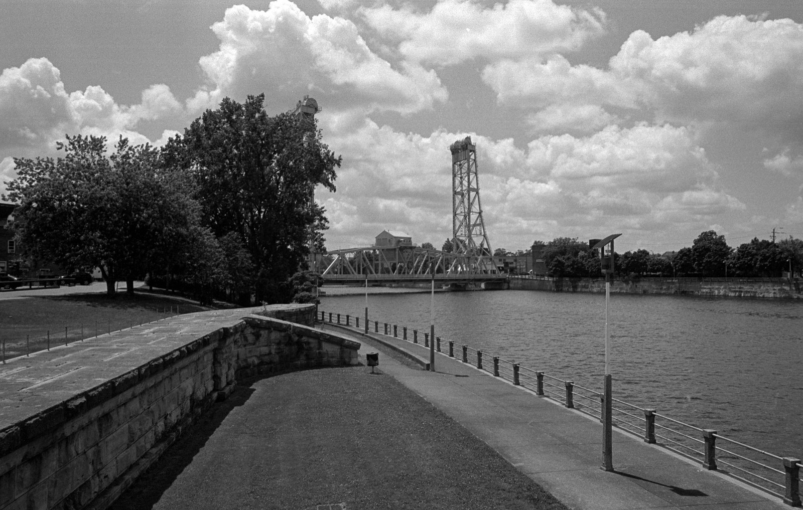
Minolta Maxxum 9 – Minolta Maxxum AF 28mm 1:2.8 – Kodak Tri-X 400 @ ASA-400 – Kodak D-76 (1+1) 9:45 @ 20C
Minolta Maxxum 9 – Minolta Maxxum AF 28-135mm 1:4-4.5 – Kodak Tri-X 400 @ ASA-400 – Kodak D-76 (1+1) 9:45 @ 20C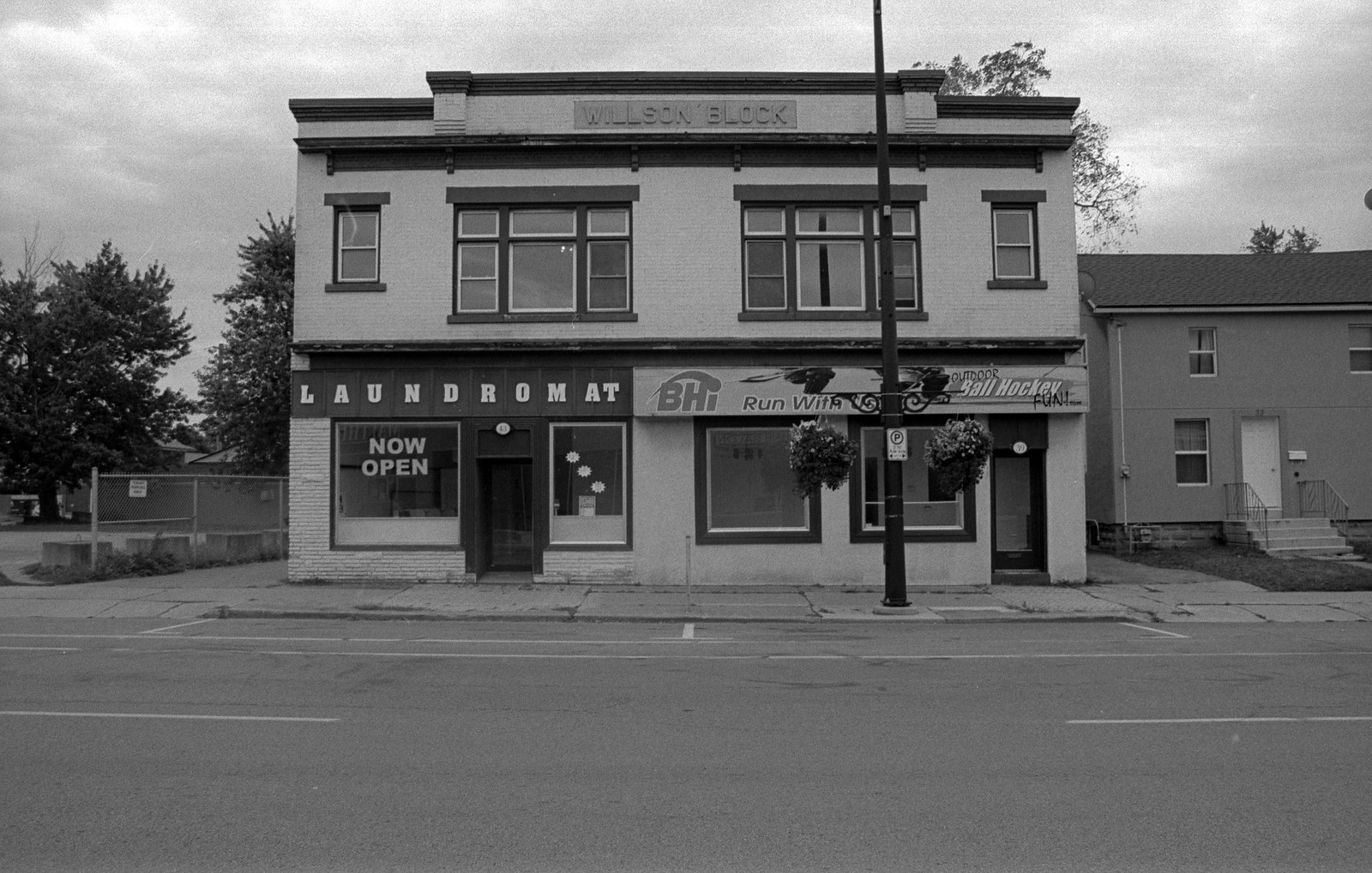
Minolta Maxxum 9 – Minolta Maxxum AF 28-135mm 1:4-4.5 – Kodak Tri-X 400 @ ASA-400 – Kodak D-76 (1+1) 9:45 @ 20C
Despite the overall industrial decline through all three of these major cities along the canal, there has also been a great deal of urban renewal. Thorold and St. Catharines have seen a great deal of improvement in their downtowns and smaller communities within their reaches. And while Welland is still in a bit of a grip of urban decline the downtown is seeing some improvement. But there are still areas in all three that look somewhat downtrodden. And yet I see a certain charm in all three and certainly want to revisit all of them and take a closer look through what their communities have to offer.
Written with Files From:
Jackson, John N. The Welland Canals and Their Communities: Engineering, Industrial, and Urban Transformation. University of Toronto Press, 1997.
Styran, Roberta M., and Robert R. Taylor. This Colossal Project: Building the Welland Ship Canal, 1913-1932. McGill-Queen’s University Press, 2016.
Styran, Roberta M., and Robert R. Taylor. This Great National Object: Building the Nineteenth-Century Welland Canals. McGill-Queen’s University Press, 2012.
Styran, Roberta McAfee, and Robert R. Taylor. Mr. Merritt’s Ditch: a Welland Canals Album. Boston Mills Press, 1992.
Jackson, John N., and Fred A. Addis. The Welland Canals: a Comprehensive Guide. Welland Canal Foundation, 1982.
Styran, Roberta M, et al. The Welland Canals: the Growth of Mr. Merritt’s Ditch. Boston Mills Press, 1988.