There is always a plus of having inside information; you must be careful when exploring former government sites, especially those used by both the military and the police as training locations. So when I got word that a former Cold War radar station was open for exploration, I jumped to head up to the Barrie area to check it out. Sadly, the base had been an adult occupational centre longer than a military base. While there were still plenty of military buildings around, there were only a few clues to the base’s history.
Nikon D70s – AF-S Nikkor 18-70mm 1:3.5-4.5G ED DX
Almost as soon as the Second World War ended, a new Cold War erupted, silent and underground, fought through proxies and spies, and fueled by the new atomic era. Both Canada and the United States feared an attack over the North Pole by the Soviets with long-range nuclear-armed bombers. In 1946, the two nations began planning a line of radar stations to provide an early warning. Britain made use of radar with their Chain Home system that provided early warning for inbound Nazi bombers and with telecommunications coordinated land-based fighter units and anti-aircraft lights and guns. Money for constructing a joint operation to construct a series of radar stations across Canada was authorised, and construction began in 1949. Twenty-two stations were built and operated by the United States Air Force (USAF), and an additional sixteen were constructed by the Royal Canadian Air Force (RCAF). These stations were situated along the fifty-third parallel, and many started operations in the early 1950s. The stations were grouped into zones, with a station acting as the central coordination station. No. 204 RCAF Radio Station, located near the small village of Edgar, near Barrie, Ontario, was one such station that began operations in September 1952. The station was divided into two sections: the operations area at the highest point housed the radar domes and the operations building. The domestic area below housed the private married quarters, barracks, combined mess, sick bay, support buildings, and other buildings. Within a month, the station became RCAF Edgar. The men and women serving were connected with No. 31 Aircraft Control & Warning Squadron and No. 3 Air Defence Control Centre. RCAF Edgar coordinated with four other radar stations to confirm inbound threats and coordinate an appropriate response from land-based units, including interceptor aircraft. This job was done in the earliest days through a manual process with telephones, physical maps, and markers. The trouble was that technology had advanced by the time the entire Pinetree Line was activated in 1955, and the systems that drove the Pinetree Line needed to be revised in light of jet technology and ballistic missiles. Two new lines of radar stations were completed between 1956 and 1957. While the Pinetree line could still play a role, the introduction of a computerised command and control system, the Semi-Automatic Ground Environment (SAGE), powered by an IBM AN/FSQ-7 and the formation of NORAD, made RCAF Edgar of less importance by the time SAGE was installed at the base in 1961, No. 3 ADCC was dissolved, and the main squadron, No. 31 was redesignated No. 31 Radar Squadron. Opening a new NORAD centre at RCAF North Bay would seal Edgar’s fate, and the official closure would come in 1964. The official closing parade took place on 8 April 1964.
Konica Minolta DiMAGE Z2 – Konica-Minolta GT Lens 38-380mm 1:2.8-3.7 APO
Konica Minolta DiMAGE Z2 – Konica-Minolta GT Lens 38-380mm 1:2.8-3.7 APO
Konica Minolta DiMAGE Z2 – Konica-Minolta GT Lens 38-380mm 1:2.8-3.7 APO
Konica Minolta DiMAGE Z2 – Konica-Minolta GT Lens 38-380mm 1:2.8-3.7 APO
Konica Minolta DiMAGE Z2 – Konica-Minolta GT Lens 38-380mm 1:2.8-3.7 APO
Following the base closure, the operations centre, SAGE building, and the radar towers were demolished in preparation for the sale of the entire property. The Butler building, the only building that once provided radar operations, was left intact. In 1965, the Ontario Government purchased the site for 218,000$ or approximately 2,000,000$ in 2023. The provincial government converted the area into a self-sufficient town called the Edgar Adult Occupational Centre. The new AOC would provide meaningful employment and living quarters and teach skills to lower-functioning adults. Some would learn skills to allow them to move and live independently, while others stayed for much of their adult lives. Toronto businesses often send items to be sorted, assembled or packaged to Edgar for the residents to provide those services. Initially successful, the drive towards deinstitutionalisation, along with funding cuts and staff cuts, resulted in many residents facing abuse in many different forms. These incidents occurred through 1970 and into the 1990s before the AOC closed in 1999. The province put the site up for sale again at the cost of 3,000,000 and had an Indigenous group express interest in converting the site to provide better housing for Indigenous peoples. The sale fell through in the early 2000s. The site was abandoned, and a single guard was stationed at the entrance to keep people out. They could not patrol, opening the base up to anyone who could get in without being seen. It wasn’t until 2011 that a new developer purchased the entire site. Still, by this point, none of the buildings were worth saving, and through the late summer and into the fall of the same total area, the entire base was wiped off the map. The goal is to build a small retirement village. However, as of 2023, that process hasn’t started, with only basic land reshaping completed.

Nikon D70s – AF-S Nikkor 18-70mm 1:3.5-4.5G ED DX
Nikon D70s – AF-S Nikkor 18-70mm 1:3.5-4.5G ED DX
Nikon D70s – AF-S Nikkor 18-70mm 1:3.5-4.5G ED DX
Nikon D70s – AF-S Nikkor 18-70mm 1:3.5-4.5G ED DX
Nikon D70s – AF-S Nikkor 18-70mm 1:3.5-4.5G ED DX
I didn’t know why I put Edgar in round one when I compiled a list of sites for this year’s posts on my adventures exploring abandoned locations. It isn’t a worthy location, but I only visited the site sometimes. I went back and looked through my entire album and only counted three visits. There were a few reasons for that. First, I did not find it overly attractive. Despite being the centre of the earliest efforts to detect inbound Soviet nuclear bombers, Edgar spent more time as an Adult Occupational Centre. Most of the military/radar equipment had long been removed when I first visited. The second reason is getting into the location; Edgar was my first experience with a sizeable spread-out complex. Through the early 2000s, security had been reduced to a minimum, with a single guard stationed at the old guard house at the entrance to the property. The security company also removed the need for patrol, which made it easy to get on and off the property and, unless you walked up to the front of the domestic section, were pretty safe. There was always a chance of being discovered because we had to hike onto the property from the rear and pass near active tall towers, which always added an extra layer of risk. Once on the base, you had to watch out how far forward you went out of fear of being seen by the guard at the booth. After doing two trips close together in 2006 and 2007, it wasn’t until 2011 that I returned before the entire site fell to demolition. And it wasn’t until 2012 that I uploaded the few film shots I got. The biggest problem with Edgar was that I had so much potential in my head for the site that it was quickly dashed by how empty it turned out to be. The one thing I remember clearly about my visits to Edgar is how hot those days were; trips were always in the middle of summer, and the smell from the buildings with all the mould and other nasty stuff. You would often hustle between buildings as there was some cover outside, but not much.

Nikon D70s – AF-S Nikkor 18-70mm 1:3.5-4.5G ED DX
Nikon D70s – AF-S Nikkor 18-70mm 1:3.5-4.5G ED DX
Nikon D70s – AF-S Nikkor 18-70mm 1:3.5-4.5G ED DX
Nikon D70s – AF-S Nikkor 18-70mm 1:3.5-4.5G ED DX
Nikon D70s – AF-S Nikkor 18-70mm 1:3.5-4.5G ED DX
Having only visited the site three times, I felt my photography didn’t grow between the first two visits. I only had a few images from my final visit and didn’t see them as reasonable. The early visit shows that I was still in my snapshot phase but already paying more to composition. You can see some use of leading lines, especially in those hallway shots. Another thing I started to work more with is lower ISOs, which helped with the image quality that the DiMAGE Z2 outputted. That first trip resulted in many images; I even shot an original Agfa APX 400 roll of film with my X-7a. But that first trip was also the last trip for my Z2, as it got knocked off the roof of a building while taking a shot of the transmitter tower where the radar towers once stood. That resulted in a quick shift from bridge cameras (with a brief interlude with a Panasonic FZ-7) to a digital SLR. It was the D70s that came along on the second trip. I was better with my composition and exposure (mostly). I saw more of the base and got many more exterior shots. We were still in the times when the guards were stuck at the front gate. By the final trip, I don’t know why I didn’t have any digital images from that day, but I ended up with an X-700 and Rolleiflex 2.8F, both with colour film. Those shots were okay, but we were also at the end of life, so there was a more significant security presence as demolition had started. In all honesty, Edgar didn’t make me a better photographer, but it got me into a better gear set.

Minolta X-700 – Minolta MD Rokkor-X 45mm 1:2 – Kodak Ektar 100 @ ASA-100 – Processing By: Silvano’s
Minolta X-700 – Minolta MD Rokkor-X 45mm 1:2 – Kodak Ektar 100 @ ASA-100 – Processing By: Silvano’s
Rolleiflex 2.8F – Carl Zeiss 80mm Planar 80mm 1:2.8 – Kodak Portra 400 @ ASA-400 – Processing By: Silvano’s
Rolleiflex 2.8F – Carl Zeiss 80mm Planar 80mm 1:2.8 – Kodak Portra 400 @ ASA-400 – Processing By: Silvano’s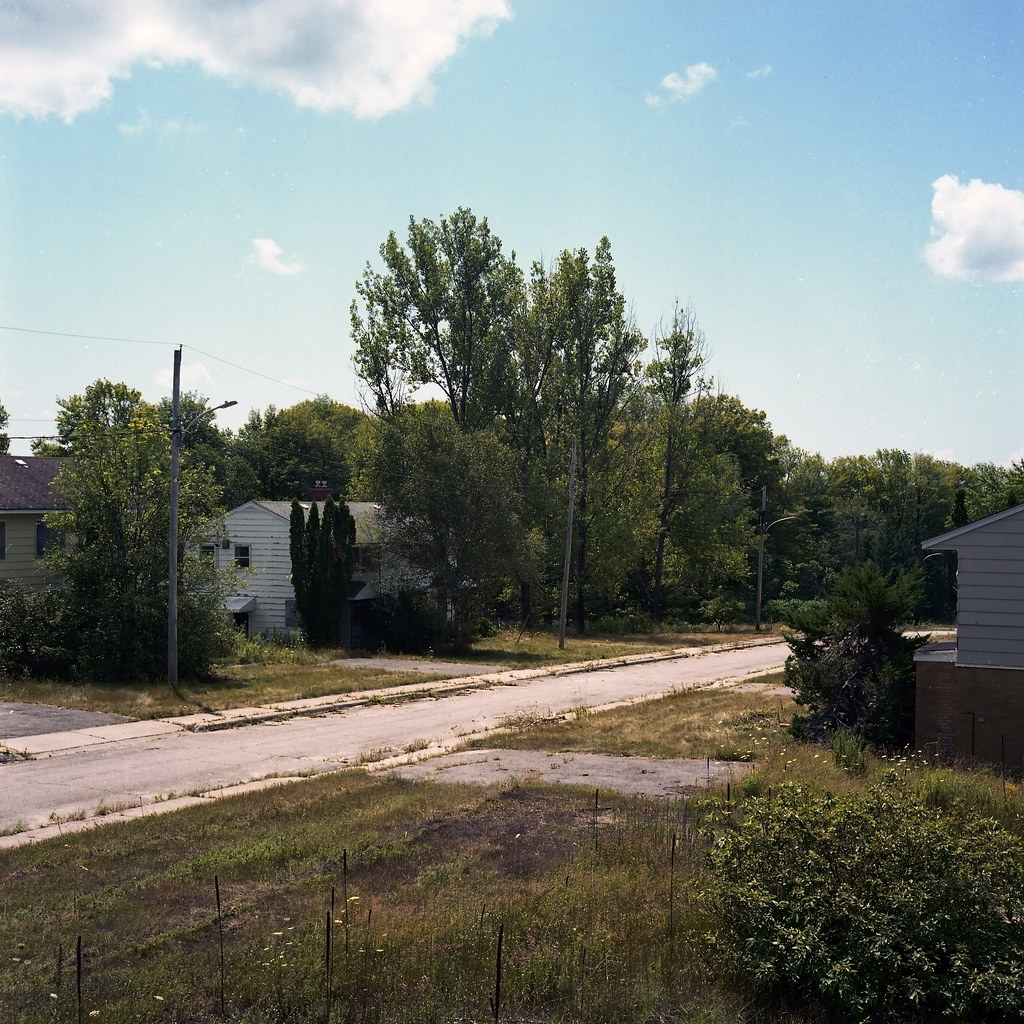
Rolleiflex 2.8F – Carl Zeiss 80mm Planar 80mm 1:2.8 – Kodak Portra 400 @ ASA-400 – Processing By: Silvano’s
What is rather interesting about Edgar is that during its time as a radar station, the technology had moved on by the time it was fully operational; even after being modernised, it was already obsolete. If we think that technology moves at a breakneck speed today, it was moving at the same pace through the early years of the Cold War. Despite being disappointing as a military site, Edgar provided a decent spot to explore if you wanted a wide open space. But Edgar still stands out as the spot which catapulted me into bigger and better cameras and fueled my thirst to head further north to check out better radar stations. You can see all my photos from Edgar over on Flickr. You can find a large selection of historical photos from 1952 to 1999 upon closure and a few from post-closure (2000-3) over on the C&E website.
Glossary of Terms
Radar: Radar is a radiolocation system that uses radio waves to determine the distance (ranging), angle (azimuth), and radial velocity of objects relative to the site. It is used to detect and track aircraft, ships, spacecraft, guided missiles, motor vehicles, map weather formations, and terrain.
Chain Home: The codename for the ring of coastal early warning radar stations built by the Royal Air Force before and during the Second World War to detect and track aircraft. Initially known as RDF, and given the official name Air Ministry Experimental Station Type 1 in 1940, the radar units were also known as Chain Home for most of their life. Chain Home was the first early warning radar network in the world and the first military radar system to reach operational status.
Pinetree Line: The Pinetree Line was a series of radar stations located across southern Canada at about the 50th parallel north, along with a number of other stations located on the Atlantic and Pacific coasts. Run by North American Aerospace Defense Command (NORAD). The line was the first coordinated system for early detection of a Soviet bomber attack on North America, but before the early 1950s radar technology quickly became outdated and the line was in full operation only for a short time.
NORAD: North American Aerospace Defense Command, known until March 1981 as the North American Air Defense Command, is a combined organization of the United States and Canada that provides aerospace warning, air sovereignty, and protection for Canada and the continental United States.
Semi-Automatic Ground Environment (SAGE): The Semi-Automatic Ground Environment (SAGE) was a system of large computers and associated networking equipment that coordinated data from many radar sites and processed it to produce a single unified image of the airspace over a wide area. SAGE directed and controlled the NORAD response to a possible Soviet air attack, operating in this role from the late 1950s into the 1980s.
Deinstitutionalisation: Deinstitutionalisation is the process of replacing long-stay psychiatric hospitals with less isolated community mental health services for those diagnosed with a mental disorder or developmental disability. In the late 20th century, it led to the closure of many psychiatric hospitals, as patients were increasingly cared for at home, in halfway houses and clinics, in regular hospitals, or not at all.
My sister was a resident here in 1980’s. Im writing a book about her experience and wanted to know if i could use some of your photos on my social media. The book will not have your photos in it. I will give you credit
Go for it with proper Credit! Good luck with the book!