I have this memory that recently floated up to the surface of a camping trip I took many years ago with my dad and brother. We were camping at Sherkston Shores a camping resort half-way between Fort Erie and Port Colborne. While I have excellent memories of swimming in the old quarry and the three waterslides, but less clear is a visit we made one trip to the Welland Canal. We’re all unclear as to what lock we visited. My brother remembers stores. And there was also the stranger who gave us chocolate bars (through our dad) on that same trip. I’m sure buried in a family photo album there is a couple of snapshots of us at the Canal. Then I had no idea the importance of the Canal or that it was even the Fourth iteration of the historical Welland Canals. Today the Fourth Welland Canal is part of a vast trade route that is part of the global economy as part of the greater St. Lawerence Seaway. It realizes the original dream of William Hamilton Merritt. Even by the time, the Third Canal had been completed. It was clear that a new Canal would be needed sooner rather than later. Ships operating on the great lakes were growing larger and showing no signs of stopping. There was also the increase in lock sizes on the St. Lawerence and the start of discussions of turning it into a deep water passage to allow ocean-going vessels onto the Great Lakes. And while the Third Canal had its depth increased, and despite the size of the locks, there was no way ocean-going ships could operate on the Canal. The Mountain Locks would be a huge barrier. And Canada needed an efficient way to get the wheat grown in the Prairies out to its markets in England and Western Europe, not to mention the push into Northern Ontario which revealed a vast wealth in common and precious metals.

Minolta Maxxum 9 – Minolta Maxxum AF 28mm 1:2.8 – Kodak Tri-X 400 @ ASA-400 – Kodak D-76 (1+1) 9:45 @ 20C
Minolta Maxxum 9 – Minolta Maxxum AF 70-210mm 1:4 – Kodak Tri-X 400 @ ASA-400 – Kodak D-76 (1+1) 9:45 @ 20C
Major John Laing Weller would head up the government survey efforts starting in 1890. The Major, a graduate of the Royal Military College of Canada, was among the first Engineers in the Canadian Militia. He had experience with Canals after being a part of the construction of a new Canal lock at Cornwall, Ontario. The Government didn’t leave anything to chance, while the existing Canal corridor pushed to have an updated Canal built along the Niagara Penisula, which also is what Major Weller preferred. The Government had to explore the construction of a whole new Canal. With activities taking place up North and to have ships move through primarily Canadian water the Georgian Canal could cut from Georgian Bay to Lake Ontario. While a sound plan, there were two main flaws. The first being the creation of a new artificial channel cut through the Canadian Shield, such a channel, cut to the depth needed caused the cost to spiral out of control. The Second would be the approach to Lake Ontario was among the most populous area of the Province. Such a Canal would remain on the books until the 1911 Federal Election, by 1907 Major Weller had dismissed the creation of a whole new Canal. Reusing the existing Canal corridor made more sense, the deep cut above the Niagara Escarpment could easily be expanded, and the Government was putting the final touches on a one million bushel grain silo at Port Colborne (which would open in 1908). And while the Erie Canal was winding down and the United States becoming more focused on the Railroad the Welland Canal corridor had extensive rail links across Canada and the United States. The biggest concern for the new Canal was the Mountain Locks and the route to the Niagara Escarpment from Lake Ontario. Weller explored several different routes, the most radical saw the Canal exit onto Burlington Bay, others were more local with Jordan Harbour, Fifteen Mile Creek, and Ten Mile Creek. Burlington Bay would prove too costly, and the hydroelectric generating station at DeCrew Falls nixed Jordan Harbour. Fifteen Mile Creek was unable to support the new locks as the banks were found to be sand. This left only the Ten Mile Creek Route, which again was Major Weller’s favourite. And it almost drew a direct straight line from Port Colborne. In 1910 the survey was done, and the Port Colborne to Ten Mile Creek route saw final approval. Sadly the route would prove to tear up fertile farmland, wipe two 18th Century villages off the map and destroy another scenic waterfall.

Minolta Maxxum 9 – Minolta Maxxum AF 28mm 1:2.8 – Kodak Tri-X 400 @ ASA-400 – Kodak D-76 (1+1) 9:45 @ 20C
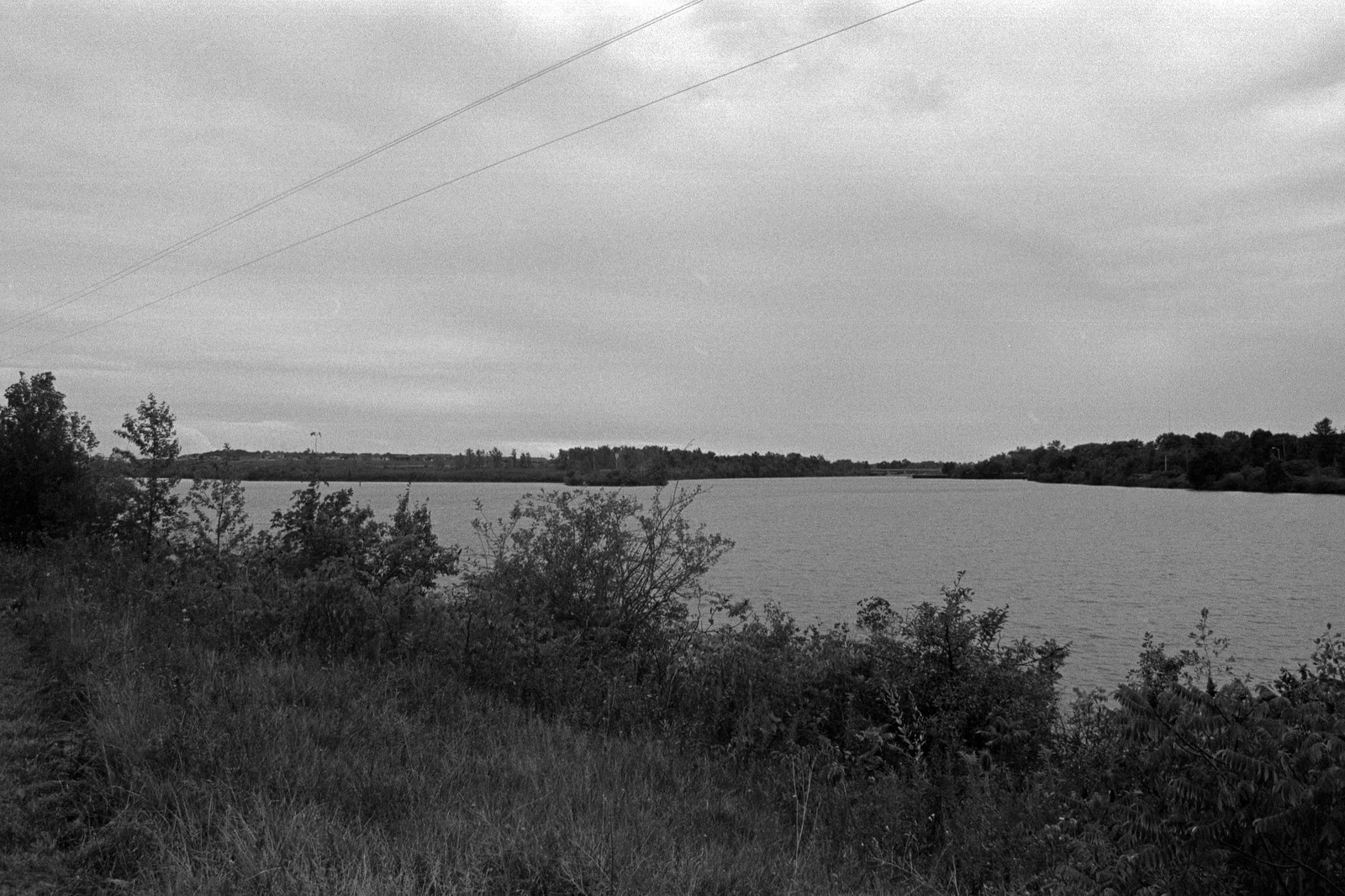
Minolta Maxxum 9 – Minolta Maxxum AF 50mm 1:1.7 – Kodak Tri-X 400 @ ASA-400 – Kodak D-76 (1+1) 9:45 @ 20C
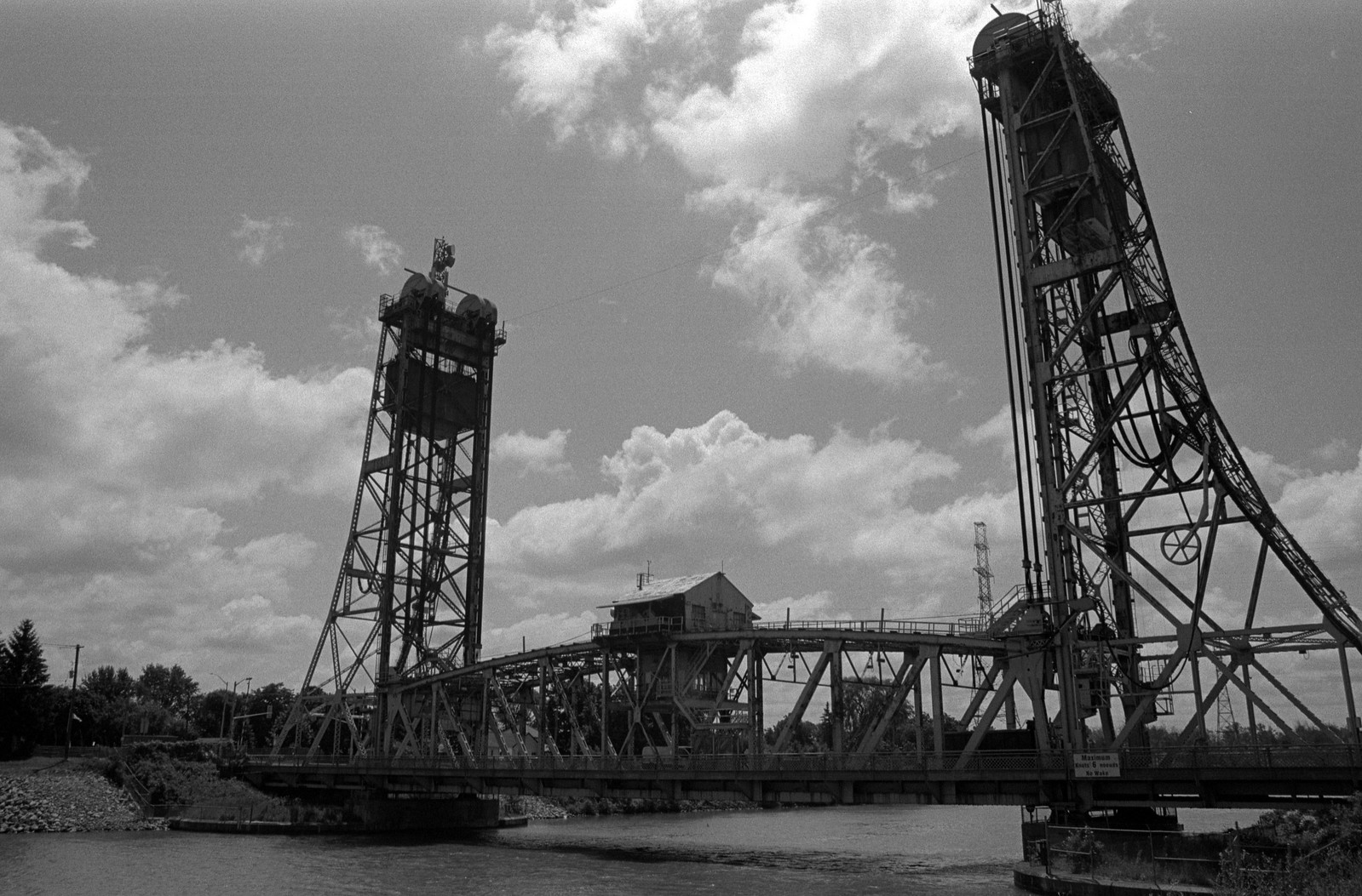
Weller’s plan called for a Canal designed specifically for ship traffic; there would be no secondary uses for the new Canal for power generation or access into local waterways. Ship captains hated Canals, they feared damaging their ships, or the Canal locks, so the fewer locks, the better. Also, the route would need to be as straight as possible and give enough clearance for ships to pass each other. As a result, the new Welland Canal operated on eight locks. Three single locks took ships from Lake Ontario to the Niagara Escarpment. These gave a bit of lift each. At the Escarpments, four locks would take ships directly up the cliff face rather than a sweeping route as the three previous Canals had done. These flight locks would be twinned allow ships to travel in opposite directions simultaneously. From there the path would follow the Deep Cut, crossing through downtown Welland and exiting at Port Colborne with a final Lock that was little more than a Guard Lock to control any changes in water level on Lake Erie. Lock 8 would be located further inland, between Port Colborne and Humberstone. Additionally, plans were made to build a series of Lift and Swing Bridges to allow for rail and automotive traffic to cross the Canal at various key locations. Electromechanical links would control lock functions would use electric motors and manual controls to fill and drain the locks and open and close gates. Similar systems would control the lift and swing bridges. Shovels would go in the ground in 1913, but no longer would the heavy work being done by hand, heavy machinery, tugs, dredges, and railways would power the construction of the Canal. Often the equipment was made by manufacturing throughout the Canal communities. Stone and wood were replaced with concrete and steel, also coming from mills and works along the Canal. Construction work was divided into two parts, the first the dry work was digging the new channel from Lake Ontario to the Niagara Escarpment. And wet work was the digging of a new harbour at Ten Mile Creek and expanding the channel from the Niagara Escarpment to Port Colborne. The real song and dance were keeping the Third Canal in operation while building the new Canal. The whole area swelled in population, smaller communities, like Port Robinson, welcomed to new workers, and the singles in the communities did not want for a date at weekend dances. The Government estimated that the project would be completed in 1918. A year into the project, Arch Duke Franz Ferdinand, crown prince to the Austro-Hungarian Empire was gunned down in the streets of Sarajevo. Through a complex series of treaties, alliances, combined with an ongoing arms race and a great deal of sabre rattling, the Great War opened in the summer of 1914. Construction of the Canal managed to continue until 1916 when the slow meat grinder of the Western Front demanded more and more from the Canadian population and economy. The partially completed Canal became a target of a German plot, at least according to an American Grand Jury. Although the lynchpin of the plot, Von Papen, wasn’t even in North America at the time. The Great War ended in 1918, although most troops would not return for another year, those who did return and needed work were sent to a different project. The Queenston Energy Project, one of the first modern hydroelectric generators took priority over the Welland Canal Project as the Province was deep into a modernization project of the electrical generation system. And while some work on the Canal restarted in 1919, it was mainly to supply work for returning troops. One change that required rework of Locks 1 and 6 was the change to a mitred lock gate, the mitred gate allowed for just that little bit of extra space for ships inside the lock. When the Queenston project started to wrap up in the early 1920s, many of the workers were redirected back to the Canal, and work began in earnest. Despite using heavy equipment, the Canal project found new ways to kill workers as well as some of the older ways. Throughout the project, 137 men lost their lives on the project, making it one of the deadliest of the Twentieth-Century. Men were drowned, crushed, electrocuted, fell, or were buried alive. Two of the deadlier accidents took place in the late 1920s, the first in 1927 when a cofferdam collapsed on the 10th of December during the construction of the Main Street Lift Bridge in Welland. Three men were killed. The second in 1928, during work on Lock 6 two cranes carrying a steel beam collapsed under the weight, killing ten. When the stock market crash in 1929 resulted in a massive economic depression sweeping the world, work on the Canal did not stop but slowed down. The Government could use the Canal project to employe citizens, but private firms providing material to the project were outside of the Government control. Despite these setbacks, the Canal began operations in March 1932. Major Weller would die in May that same year. The grand opening of the Canal took place in August to coincide with the British Empire Economic Conference. Speakers at the event included Prime Minister Richard Bennett and the Honorable Robert Manion the Miniter of Canals and Railways. Every leader of the entire British Empire attended the event which took place in full view of the massive Flight Locks between Merritton and Thorold. The official opening of the Canal fell to Sir Vere Ponsonby, 9th Earl of Bessborough, Governor-General of Canada who dedicated the Canal to world commerce and trade. The guests looked on as the SS Lemoyne, then the longest ship operating on the Great Lakes (a title it held until the 1950s) navigated the Flight Locks. Construction on the Canal, however, would continue, with the final depth and all bridges being completed by 1935.

Minolta Maxxum 9 – Minolta Maxxum AF 28mm 1:2.8 – Kodak Tri-X 400 @ ASA-400 – Kodak D-76 (1+1) 9:45 @ 20C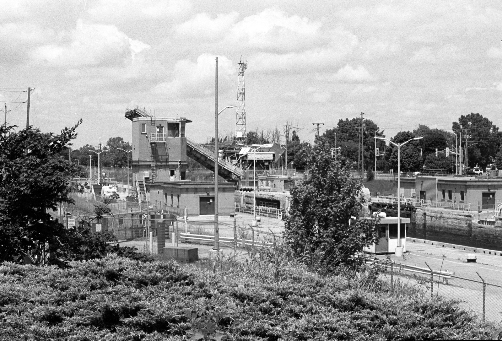
Minolta Maxxum 9 – Minolta Maxxum AF 70-210mm 1:4 – Kodak Tri-X 400 @ ASA-400 – Kodak D-76 (1+1) 9:45 @ 20C
With the new Canal completed, traffic was taken off of the historic canals; both the Third and Second Canal were still operating in some limited fashion. Navigation onto the Second Canal was officially cut off, and traffic onto the Third Canal curtailed (navigation onto the Third Canal would be completely cut off in 1968). The Welland Canal proved to be an engineering marvel, surpassing that of even the Panama Canal. Panama’s Gutan Locks lifted ships up and down twenty-six meters. The Welland Flight Locks lifted ships up and down forty-three meters. The new direct route allowed ships to travel under their power and could transit the Canal in twelve hours. Local communities began to reclaim older canal lands, filling in trenches to allow for new construction to replace any land that had been lost to the new channel’s construction. Thorold turned one such channel into a downtown park, where relocated Anglo-American War of 1812 memorials would live. However, they left the top portion of a Second Canal lock visible above ground. Port Dalhousie’s Martindale Pond became the first significant cleanup to allow for better use by the Royal Canadian Henly Regatta. And while the new Canal offered little to the local communities, it did bring in a great deal of tourist traffic to former industrial communities of Merritton and Thorold, both of which had been hit the hardest by the Great Depression. The Fourth Canal was also the first one designed to interact with automotive traffic directly. Still, the one thing that the designers did not count on was how popular the personal automobile would become. The lift and swing bridges were built by and operated by the Welland Canal, giving priority to ship traffic. The Department of Highways was in charge of the roads and had no say in how the Department of Canals and Railways operated. While along smaller local roads the trouble wasn’t too bad, the highway bridges, proved troublesome in the mid-century. Four King’s Highways crossed the Welland Canal. While the smaller highways such as Highway 3, 58, and 20 were no major troublespots, it was the Queen Elizabeth Way, Ontario’s first limited-access Freeway that crossed at Queenston Road bridge that caused the largest bottleneck. While the Department of Highway would resolve the issue by building a high-level bridge, the Garden City Skyway, that sails over the top of the Canal allowing unimpeded traffic for both cars and ships saw completion in 1962. The town of Welland also wasn’t too keen on the canal bridges; it disrupted traffic through the downtown. It was so bad the city could not operate a public transit system because of the Canal. Ship operators were also not too happy about Welland. With nearly half a dozen bridges to travel through and the gentle curve of the cut. The worst bridge for ship operators was Bridge 15, completed in 1910, the twin-track Baltimore Swing Bridge (a rare example here in Canada), the problem with Bridge 15 is that it rotated along a central pillar. The running joke was that no ship escaped not scraping its hull on that pillar at least once. And as the St. Lawerence Seaway started construction in the early 1950s, it seemed that the Welland Canal, now in operation for a couple of decades would need an update as deepwater ocean vessels would soon be operating on the Great Lakes.
Minolta Maxxum 9 – Minolta Maxxum AF 28mm 1:2.8 – Kodak Tri-X 400 @ ASA-400 – Kodak D-76 (1+1) 9:45 @ 20C
Minolta Maxxum 9 – Minolta Maxxum AF 28-135mm 1:4-4.5 – Kodak Tri-X 400 @ ASA-400 – Kodak D-76 (1+1) 9:45 @ 20C
The idea of a deepwater route along the St. Lawrence River is nothing new, William Hamilton Merritt during his time in the Provincial Parliament (pre-Confederation) worked to standardize Canal Locks across all of the waterways and dreamed of his Canal being part of a grander trade route. The first discussions about a deepwater course came in the 1890s; this American lead project met with a lukewarm reception in Canada, who was more interested in developing hydroelectric generation along the river. It also didn’t help that neither side could agree on how the project would work (a common theme). While both sides would wrangle about the idea through the first couple of decades of the twentieth century, it wouldn’t be until 1932 that a treaty of intent was signed. Canada was now game for the project, now that the new Welland Canal was in operation, as was the American President. The problem lay with the US Congress, while many in the Senate and House were good with the idea, lobbyists who represented US Railways, Harbours, and Inland Waterways weren’t too keen and pushed for the body to vote down the bill. Even the idea of charging tolls on the waterway failed to sway. It worked, the bill was unable to meet the needed two-thirds majority in the House in 1934. Two years later, with the Depression still ranging, President Franklin Delano Roosevelt, revived the project to provide jobs for thousands in the construction project. This time both sides, seeing the economic advantage were game to negotiate in good faith and by 1941 a formal treaty was signed by both parties. The Second World War delayed the project, and even after the war, the United States seemed to have cooled to the idea as more automotive traffic began to move goods across the country. Canada, however, gaining a new sense of national identity decided they would push ahead with the project with or without the help of the United States. The Canadian Parliament sent a letter to the US Government in 1951 that they intended to develop the project on their own. The message was enough to get the American Government onside, and on the 10th of August 1954, the project opened. In addition to size increases both in width and depth of the St. Lawerence, a series of new locks were built and a massive hydroelectric station at Cornwall, Ontario was completed. The project was not without trouble, the creation of the Seaway forced the relocation of several communities along the river’s edge and the sinking of the Chrysler’s Farm Battlefield. Highway Two and several railroad routes were relocated on the project. The seaway project opened for traffic on the 25th of April 1959, the official opening attended by Her Majesty Queen Elizabeth II aboard HMY Britannia along with Prime Minister John Diefenbaker and President Dwight D. Eisenhower officially opened the Seaway on the 26th of June that same year. With the Seaway completed, the Welland Canal (which had been under the Ministry of Transport since 1936) was given over the St. Lawerence Seaway Authority, who could now begin work on a Welland Bypass.
Hasselblad 500c – Carl Zeiss Planar 80mm 1:2.8 – Ilford FP4+ @ ASA-100 – Kodak D-23 (Stock) 6:00 @ 20C
Hasselblad 500c – Carl Zeiss Planar 80mm 1:2.8 – Ilford FP4+ @ ASA-100 – Kodak D-23 (Stock) 6:00 @ 20C
The new bypass and overall upgrade to the Canal were two-fold, the first was to increase the canal depth to 8.2 meters the second to eliminate the bottleneck at Welland, Ontario. Initially, the plan was to bypass both Port Colborne and Welland and built a new Lake Erie Terminus, but the cost and urban growth prevented such a move, instead only Welland would be bypassed. For the Authority the acquisition of land proved far less controversial, much of the land was poor farmland that the owners were planning on selling to retire, overall the Authority purchased 2630 hectares of land. Realizing that if new bridges were installed the problems that created the need for a bypass would only return, instead, the Authority worked with the Ministry of Transport to build tunnels under the Canal using a cut and cover method. The new bypass would start at Port Robinson and rejoin the original canal route just above Port Colborne. The dirt dug up for the Canal turned into new hills which acted as a windbreak. A local pulp and paper mill began a tree-planting project to reforest the area. Construction started in 1967, and the bypass opened for operations in 1973. The question of what to do with the old channel through Welland was answered as the Authority turned it over to the city along with all the bridges. Some of the old lift bridges were replaced and fixed bridges installed, many old lift bridges remain in place. The actual channel became a new recreational waterway and home to personal docks, small boats and rowing clubs, after extensive environmental remediation efforts. The 1970s brought the first major accident to the Canal, the MV Steelton after failing to sound its whistle on approach to Bridge 12 at Port Robinson collided with the slowing raising road deck. The bridge operators had spotted the ship and began the process of ensuring the deck was clear and starting the lifting engines. The collision caused only minor damage to the ore carrier, but the bridge was totalled, the deck collapsed into the channel, and the two towers fell in shortly after. Thankfully there had been no loss of life, but it crippled Canal traffic until the 9th of September. The two collapsed towers forming a macabre tourist attraction at Port Robinson and cutting road traffic between the two halves of the community. The Seaway Authority investigated the installation of a new lift bridge or even a tunnel under the Canal. Still, the low traffic on the bridge made neither a viable option, at least economically. Instead, the Authority built two docks and provided a six-person passenger ferry, which operates only during the canal shipping season and could only carry people, the service started in 1977. When I was collecting images for the project on both days in June and September 2020, the Ferry remains suspended due to this time of plague. The second major accident came on the 11th of August 2001, the road deck of Bridge 11 suddenly started lowering while the M.V. Windoc was partly underneath. Unable to do anything, the ship ploughed forward, the road deck destroying the funnel and ship’s bridge while suffering little damage itself. Burning, the Windoc drifted along before grounding itself on the Canal bank, with local fire crews rushing to the scene to extinguish the burning ship. Despite the severity, no one was killed, and no major environmental damage was done. The investigation discovered that the bridge operator was impaired at the time. Ultimately the fault came down to human error in both cases, and the need to improve navigation on the Canal was clear. Also, much of the equipment operating the Canal was getting up in years, and the cost of maintaining the equipment was on the rise. Starting in 2003 a major upgrade process began where the old electric motors and mechanical links were replaced with new hydraulic drivers and Programmable Logic Controllers (PLC) and a new computer operations centre to run the entire Canal from a single location. Close-Circuit TV Cameras would monitor every kilometre of the Welland Canal and combined with improved GPS tracking; bridges could be raised and lowered before any danger came into play and lessened the risk of an accident or incident. In 2017 a new project to use a vacuum system to secure ships in the flight locks were successfully tested at Lock 7 and installation began at Locks 1 through 6 over the next several years, replacing the use of mooring ropes. Although despite all this technology, the human variable remains at play. Back on the 11th of July 2020, a little over a week after I had completed my first trip to the Canal for this project two ships, the Florance Spirit and Alanis collided in the Deep Cut, while both suffered minor damage the cause remains under investigation.
Minolta Maxxum 9 – Minolta Maxxum AF 28-135mm 1:4-4.5 – Kodak Tri-X 400 @ ASA-400 – Kodak D-76 (1+1) 9:45 @ 20C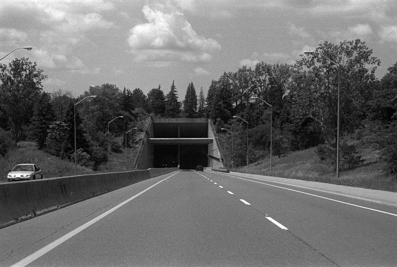
Minolta Maxxum 9 – Minolta Maxxum AF 35-70mm 1:4 – Kodak Tri-X 400 @ ASA-400 – Kodak D-76 (1+1) 9:45 @ 20C
The current Welland Canal with all the recent updates is scheduled to last until 2030, ironically near the Canal’s 200th Anniversary. Plans for a Fifth Welland Canal have been on the shelf since the 1960s, which calls for a completely new channel, bypassing all elements of the current and historical Canals with a single super lock that will take ships right up the Niagara Escarpment in a single lift. Where and how that is accomplished, remain in the Authority’s library. Today the Welland Canal operates for only a portion of the year, with the navigation season lasting from late March to early December. And surprisingly, the Canal is easy to drive along and watch as the ships transit, and there are several dedicated viewing platforms. Platforms are located at Locks 3, 7, and 8. However, you can view ships from any locks from the side of the road. And there’s something magical about seeing a ship move up or down the Flight Locks. If you are planning on taking in these ships, make sure to visit some of the smaller towns, Thorold (Lock 7) has a thriving downtown with plenty of small businesses to support. While Bridge 12 is gone, the ferry dock at Port Robinson offers a great view of the Deep Cut and Welland Bypass, and the Bridge 12 Pub makes a great meal and pint. And of course, there’s Port Colborne which has a beautiful downtown to explore and take in. Also located at Lock 3 is the Welland Canal Centre and City of St. Catharines Museum both are excellent places to learn about the history and operation of the Canal, also located there is the Workers memorial which remembers the 137 men who died on the Canal project. I encourage you to get out and explore this massive and nearly unequalled engineering marvel plus if you want to plan your visits around ships transiting the Canal, follow the Marine AIS website.
Written With Files From
Jackson, John N. The Welland Canals and Their Communities: Engineering, Industrial, and Urban Transformation. University of Toronto Press, 1997.
Styran, Roberta M., and Robert R. Taylor. This Colossal Project: Building the Welland Ship Canal, 1913-1932. McGill-Queen’s University Press, 2016.
Styran, Roberta M., and Robert R. Taylor. This Great National Object: Building the Nineteenth-Century Welland Canals. McGill-Queen’s University Press, 2012.
Styran, Roberta McAfee, and Robert R. Taylor. Mr. Merritt’s Ditch: a Welland Canals Album. Boston Mills Press, 1992.
Jackson, John N., and Fred A. Addis. The Welland Canals: a Comprehensive Guide. Welland Canal Foundation, 1982.
Styran, Roberta M, et al. The Welland Canals: the Growth of Mr. Merritt’s Ditch. Boston Mills Press, 1988.